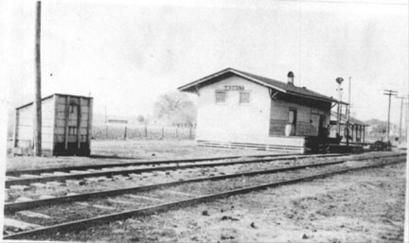
This image shows Tacon Station as it appeared in 1915.
Dauphin Street is just beyond the fruit shed, and the NOM&C mainline is to the right of the visible trackage.
There should be four tracks at this location, with interchanges between the two railroads.
The photograph has the viewer standing between the second and third tracks, looking almost due West, with the tracks
leading Northwest. The turn to the North, toward Crichton, is only a hundred yards or so farther ahead.
|
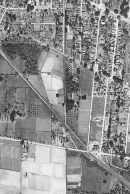
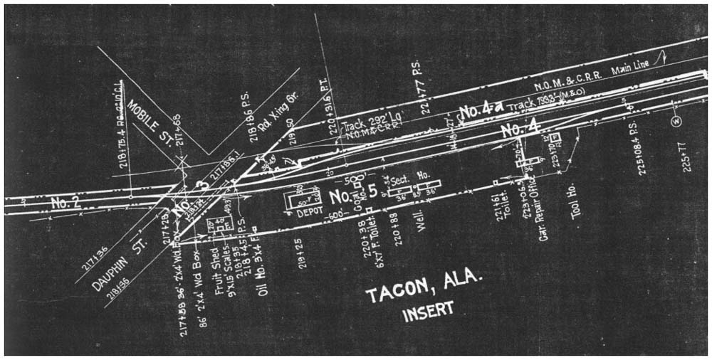
This is where the M&BS mainline crossed the MJ&KC/NOM&C mainline, and began a parallel run down to
Government Street - present-day Airport Boulevard.
Compare the aerial photo at right with the blueprint segment below. Note the original 1915 location of the station on
the opposite side of Dauphin Street. Also note the interchange tracks with the NOM&C railroad, shown as a
lightly-drawn line just above the M&BS lines. The NOM&C is today the mainline for the Illinois Central
railroad.
|
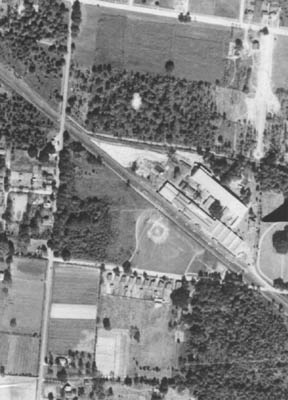
This aerial photograph shows the business that many old-time Mobilians remember as "Ruberoid", later a GAF
subsidiary. The north-south road at the left side of the image is Florida Street, and the east-west road intersecting
it at about mid-image is Emogene Street, and the one at the top of the image is Dauphin Street. Note the company
houses lined up in a row on Emogene, across from the baseball field.
|