Support this website by joining the Silver Rails TrainWeb Club for as little as $1 per month.
Click here for info.
This website has been archived from TrainWeb.org/italeritrea to TrainWeb.US/italeritrea.
This website has been archived from TrainWeb.org/italeritrea to TrainWeb.US/italeritrea.
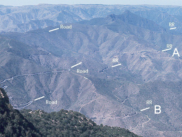
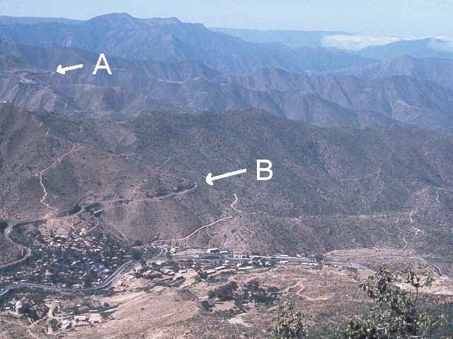
The first picture shows a broad view of the road and railroad routes above Nefasit. The second, a narrower view, shows only the railroad route from a lower vantage point. Both pictures were taken from Debra Bizan Mountain to the southeast of Nefasit valley. The first was taken from the top and the second from about half way down. The letters "A" and "B" on the two pictures point to the same locations on the railroad route in both pictures.

